Marathons, Mountains and Microbrews
Great weekend in Idaho.
I arrived at Idaho Falls around midday on Thursday, a man on a mission--to
climb Idaho's highest peak, Mt. Borah, to run a marathon in my 46th state, to
find at least one geocache, and to try out some of the local microbrew.
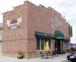 After flying for the previous six hours, (boy, were my arms tired;-)) my
hunger and thirst took me straight to the closest brewery I could find, the
Brownstone Brewery in Idaho Falls, for a sampler and a sandwich. I found the
Nut Brown especially satisfying and knew that I would be back for a pint on
Saturday night.
One of the waiters directed me to Idaho Mountain Trading, a local gear shop
where I sought the counsel of an experienced climber about the conditions on
Borah. I was encouraged by his advice as I pointed my rental car west for the
90 mile drive to Mackay (MACkey is the way they say it.) Borah is about 20
miles north of there, and with a few hours until dark, I drove on up to the
trailhead to check it out.
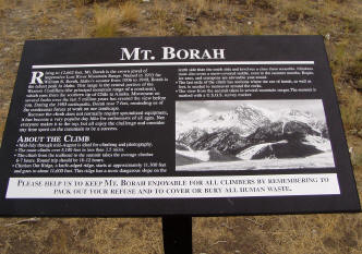
Easily finding the well-marked trailhead, I
stopped to talk to the only guy there, another climber named John, who would
camp there at the small campground and climb first thing in the morning. It
was reassuring to know that there would be someone else on the mountain, just
in case. I headed back to Mackay and got a room at the Wagon Wheel.
I got up early and arrived at the trailhead just before daylight, starting the
climb at 5:50. With a liter of water, a 20 oz. Gatorade, two Clif bars, a
jacket and a sweatshirt in my pack, I began the 3.25 mile hike up the
mountain. A couple hours, I should be at the top. NOT!
When I started, three other climbers were just ahead of me a few steps. It
was obvious that they were taking it easy, and after a short time, the guy
in back said to the one in front, "I think we have an athlete behind us who
needs to pass." They stepped aside and asked me if I had a rope--to help
pull them along with me. I never did see them again after that.
In the span of 3.25 miles, there's a mile
of elevation gain, making it an average grade of over thirty percent. After
nearly two hours, I was just clearing the tree line, with a lot of mountain
still in front of me. My legs were feeling good, I was breathing well
with no discomfort, even at 9000+ feet.
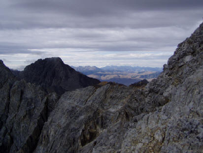 Oh well, let's see how I feel
after three hours.
As I approached the hardest part of the climb, a place called Chicken Out
Ridge, another climber, Barry, caught up with me and we talked for a minute or
two. After that, the trail disappeared and it was up to us to find a path
over the rocks, using hands as well as feet now. Barry was strong and more
experienced than me, and after a short time of traveling together; he went on
ahead, flying over the rocks as if they were no obstacle. I went a little
easier, now at around 11000+ feet, keeping three points connected to the rocks
at all times as I worked my way around and over the ridge. The climb was
challenging enough to keep me sharp, but not so much that I was afraid at any
time. What I didn't realize until afterwards was that I had just
finished crossing Chicken Out Ridge.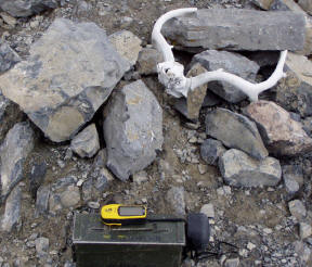
The rest of the climb is a rock-scramble, and I picked my way around the
slippery loose shale toward the last half-mile to the summit. I met John, who
had started earlier and was now on his way down, for a word of encouragement
that I was almost there. Soon I met Barry, also on his way down. I went on a
ways and wondered how much farther, when I decided to climb to the top of the
ridgeline for a different perspective. What a difference! I could now see in
front of me what looked like the summit. Though it might be called a
knife-edge ridge, there was plenty of footing, and few loose rocks. The
summit I saw was a false one, but when I crested it, I could see my goal. I
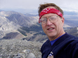
reached the highest point in Idaho, 12662 feet, in just about 4 hours. I
couldn't help myself and let out a whoop, celebrating the coolest solo climb
I've ever done. A well-bleached set of deer antlers, and an ammo box full of
logbooks marked the top. I sat down, ate a Clif Bar, had a drink, and took a
bunch of pictures before starting the long walk down.
10 other climbers greeted me as I worked my way
from the summit back to Chicken Out Ridge. As I reached the ridge, the
weather took a turn for the worse. Fog, then rain started blowing in
from the east, and I tried to stay to the west side of the ridge. With
the view blocked by the fog, I wondered if I'd ever find the end of the ridge
and the beginning of the well-trodden trail back to the bottom.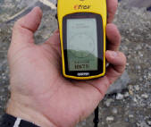
Finally, the trail became visible, but the steepness of it made progress going
down nearly as slow as when I was climbing. Loose dirt in places made it easy
to slip while constantly holding back. My quads started to shake just a
little any time I'd stop, and I was concerned what that would mean for the
marathon the next day. At one point, I slipped and landed right on my butt,
and taking advantage of my position, sat there and ate my last Clif Bar and
had some more water. I saved my last couple swallows of water because I knew
that I had at least a mile left to go. I didn't meet anyone else on the trail
until about a mile from the bottom, well below the tree line, where John
Kocian was hiking part-way up to check out the trail before climbing the next
day. He walked down with me and we discussed the climb. The company was
good--it was starting to be a long day. I finally reached the car after just
over 8 hours, sat down, talking and drinking and enjoying the rest. The climb
was complete. Now on to the marathon....
Ashton was about 100 miles away from Mackay, so after stopping for a snack
and a phone call to let my wife know I was alive after the climb, I headed
east. With about 40 miles to go, the most magnificent mountains appeared in
the distance, bright white in the afternoon sun. I never realized that the Tetons were visible from that far away. For that matter, I didn't know
exactly where they were, or that you could see them from Idaho, so it was a
nice surprise. They were my beacon all the way into Ashton. I arrived in
time for the pasta dinner.
My normal, play-it-by-ear way of doing things had me with no reservations
for a place to stay, and of course, all the hotels and motels in Ashton were
full. I was referred to a nice bed & breakfast about 10 miles out of town,
much closer than the 20 miles back to the nearest hotel.
The Stegelmaier Farmhouse Inn has four rooms available, and all of them were
open at the time, even though it was already after seven p.m. Two of us
ended up there. Unlike most B&Bs, these were farm people and were just fine
with getting up and having breakfast for us at 4:30 a.m. so we could get to
the marathon shuttle bus on time. Cathy was pulling muffins out of the oven
as I came down into the kitchen. The water had gone out overnight in the
heavy winds, but they assured me they'd have it fixed before the marathon
was over and I was welcome to come back for shower.
I could still feel the soreness in my quads as we all rode the bus to the
starting line. I thought about the downhill from the previous day, the six
thousand feet elevation, and whether my fitness level was equal to my most
physically challenging weekend ever.
My old friend, John Bozung was on the bus too. I couldn't wait to get to
the start so we could catch up on old times. John is the guy who inspired
me to run marathons on all seven continents, a feat he accomplished during
the 1997 calendar year. He also has the currently active streak
of consecutive months of marathons 119 (after today's race). Fortunately
for me, he's really out of shape lately, so he was running at about my
speed. We ran together for nine miles on a gravel road, occasionally
stopping for a picture as the Tetons or some other beautiful terrain
appeared before us. A four mile stretch of paved road was a welcomed change
from the washboard gravel. After 13 miles, John pulled ahead, and by the
time we turned onto the river trail at 13.5, I figured I wouldn't see him
again. The next three miles were a nice downhill grade along the river. I
picked up a few new running companions, and when the trail ended and we went
back onto the pavement, one of the volunteers alerted us to the upcoming
hills.
From 17-20 the road was nearly all uphill. Many people were walking by that
time, but suprisingly, my legs were feeling strong and the uphills were
going by like they weren't there! I soon caught up with John, who was
feeling the effects of his lack of training and walking most of the hills.
We turned left at around 20 miles, which to me was just didn't feel like the
right way back to town, and went through some rolling hills. I picked a
sunflower along the shoulder of the road and stuck it in my headband, set up
the 21 mile marker that had blown over, and was fully enjoying the last few
miles of the marathon. Just before 25 miles we joined the main road into
town, and I finally knew where I was. Now it's party time--the crowds,
sometimes as big as five people at a time, would cheer for us as we passed
the downtown stores toward the high school and the finish line. I finished
at 4:57:58, in 66th place, totally satisfied with my finish. The finishers medallion was laser engraved wood with our finishing number on
the back. John came in less than five minutes later in 69th. He also has
another medal from this race at home with a #3 on it.
It had stayed a comfortable temperature for the duration of the race, but as
we cooled down, the sun started heating up. The complementary Huckleberry
milk-shake from City Drug was a welcomed treat for each of the runners. I
drank it as I headed back to the B&B, where the water was working as
promised.
Now for the rest of my mission. I headed out to Squirrel
Cemetery, near the
ghost-town of Squirrel, to seek a geocache. On Wednesday night, I had
picked up a travel bug which was also trying to make it to all 50 states,
and I needed to deposit it in Idaho. After a few minutes of lifting up the
branches of a spruce tree at the corner of the cemetary, I accomplished the
mission, setting Hummer 1 back on its way. The surrounding farmland made a
great foreground for some shots of the Tetons.
I stopped back in Ashton for lunch at Mushers, where I
had Teton Ale from
the Grand Teton 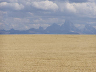 Brewing Company in Jackson Hole, WY. My goal for the rest
of the day was to do nothing but relax. As I headed back to Idaho Falls, I
stopped in Rigby for one more geocache, and drove around town with my GPS
for a while before finding the right park. After a stream crossing (on a
footbridge) and skirting the edge of a field, I found my second cache of the
day.
Back in Idaho Falls, I checked into a hotel and headed back for the
Brownstone, for my much-anticipated pint of Nut Brown, a salmon steak, and
(since I was in Idaho) a baked potato. A shot of Baileys finished off the
meal in a very satisfying manner.
At the hotel, I laid back to watch TV, and almost
lasted ten minutes.
I drifted off to sleep, thinking that the weekend I had would have killed
most guys. :-)
So, that's 46 states for marathons, 4 for highpoints. Next stop--Stowe
Vermont.
and the adventure continues....
 After flying for the previous six hours, (boy, were my arms tired;-)) my
hunger and thirst took me straight to the closest brewery I could find, the
Brownstone Brewery in Idaho Falls, for a sampler and a sandwich. I found the
Nut Brown especially satisfying and knew that I would be back for a pint on
Saturday night.
 Oh well, let's see how I feel
after three hours.


 Brewing Company in Jackson Hole, WY. My goal for the rest
of the day was to do nothing but relax. As I headed back to Idaho Falls, I
stopped in Rigby for one more geocache, and drove around town with my GPS
for a while before finding the right park. After a stream crossing (on a
footbridge) and skirting the edge of a field, I found my second cache of the
day.